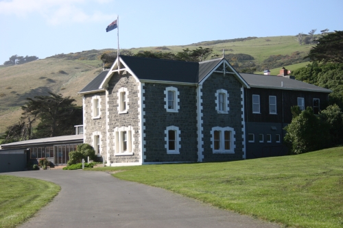
| | About Us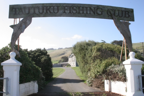 The substantial two-storey stone homestead, and the adjoining stone farm buildings were built for the Smaill family (probably Charles or his son Alexander) in the late 1870s or early 1880s at what is now known as Smaill's Beach, near Tomahawk on the rugged south coast of Otago Peninsula. The Smaills were the centre of the small farming community in the area, known for their community involvement and their progressive farming practices. The house and outbuildings recall the nature and history of community development on the Otago Peninsula, as well as the farming practices and architecture associated with the late nineteenth century developments.
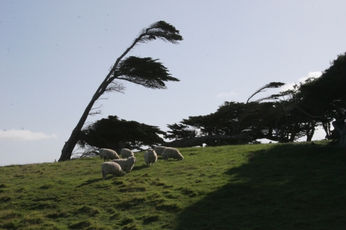
 Local historians suggest that the name Tomahawk is probably a corruption of Tomahaka (tom - a burial place, haka - dance). Maori used to travel overland along the coast, getting shellfish from the rocks and eels in the lagoons. Their old track was along the sandhills from St Clair, along the coastline to Tomahawk lagoon over the Tomahawk hills, down into Sandfly Bay, up over the Sandymount, down to Hooper's inlet and Wickliffe Bay and on to the kaik. There were various cooking places along the way.1
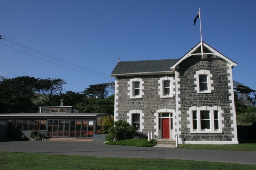 The Smaill family owned land at Tomahawk, as the area was known by the European settlers in the area in the 1860s. According to the Cyclopedia, the family had lived in a fern-tree house in the vicinity of the stone house in the 1860s.2 The homestead is thought to have been built in the late 1870s or early 1880s. Once built, an extensive garden was developed surrounding it, including some macrocarpa trees that still stand.
 Alexander Smaill took over and extended his father Charles's farm. Alexander Smaill was a prominent and active member of the Tomahawk community. He was a member of the Tomahawk Road Board, a member of the Agricultural and Pastoral Society and the Dairymen's Association. He promoted a scheme to cut a canal from the Tomahawk side of Lawyers Head through to Otago Harbour, which never eventuated. He founded a paint factory to use the haematite found in the hills surrounding his property. He was a significant supplier of milk to Dunedin. In addition he was an enthusiastic musician, with the Smaill Orchestra being well known for their entertainment on the Peninsula.3
Alexander Smaill's energy and ingenuity extended to his farm operations. He was an early enthusiast for electricity - apparently being an early user of light in his house, and in his milking shed used hydropower, generated by a dam above his house. An addition to the north elevation of the outbuildings housed the power plant. The power was used to drive a flying fox system which carried the manure from the shed up the hill behind the buildings and allowed it to be distributed over the farmland above.4

In 1916 title was issued in the name of Alexander Smaill (OT180/1 00), although it is clear that the land was owned by the Smaill family at an earlier date.5 Alexander Smaill died in 1926 and the land was transmitted to his widow Catherine Smaill and others. Catherine Smaill died in 1931. On Catherine Smaill's death in 1931, the land was transmitted to the others mentioned above. The property remained in the Smaill family until 1952.
 After some changes in ownership in the 1950s the property was bought by farmer Fergus Mathieson in 1971. Mathieson, a patron of the Tautuku Fishing Club, sold the homestead to the Club in 1972, and continues to use the outbuildings (OT180/1 00). The outbuildings are now owned by his son.
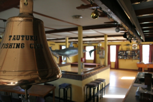
Currently the Tautuku Fishing Club uses the homestead as clubrooms, and as a function venue. The original cow byre part of the outbuildings is used to stable racehorses, with the rest largely disused.
- Goodall, M. and Griffiths, G. Maori Dunedin, Otago Heritage Books, Dunedin 1980
- Cyclopedia, p.393. See also Otago Witness, 14 July 1925, p.44.
- H. Duckworth, "History of Anderson's Bay and Tomahawk" unpublished ms, NZHPT Otago/Southland Area Office Library, Dunedin, p45-46.
- Pers comm. Fergus Mathieson, June 2005
- There is some difficulty tracing land titles in the vicinity, as there is a complex re-survey regarding land close by which was originally surveyed as road reserve, which was never formed. It has not been possible to resolve this puzzle.
Extracted from registration documents - New Zealand Historic Places Trust
| |